Pittsburgh International Airport (PIT)
Driving Directions / Travel by Car
(Pittsburgh, Pennsylvania - PA, USA)
Around 30 minutes to the northwest of downtown Pittsburgh, the region's Pittsburgh International Airport (PIT) lies near to Coraopolis, Moon, Findlay, Imperial and Independence. In close proximity to a number of fast highways and interstate roads, Pittsburgh Airport is easy to find from a variety of directions.
To the north, the US-60 highway (Beaver Valley Expressway) leads towards Elwood City and New Castle, while the US-22 (William Penn Highway) heads to the west, passing Steubenville and Bloomingdale along its route. Heading south, the I-79 interstate (Raymond P. Shafer Highway) leads to Canonsburg, Washington and beyond.
Prominent landmarks close to Pittsburgh Airport include the Pennsylvania Air National Guard to the southeast, the Airside Business Park and the Montour Heights Country Club to the east, and the Robert Morris University to the north. Also close by is the Allegheny County settlers Cabin Park to the south, next to Robinson and North Fayette.
Directions to Pittsburgh International Airport (PIT) from the city center:
- Travel along the I-279 interstate, continue and join the US-22 / 30
- Continue along this road, join the US-60 (Orange Belt) and then exit at Junction 6
Directions to Pittsburgh International Airport (PIT) from the north
- Travel along the I-279 interstate in a southerly direction
- Continue along this road and then exit at Junction 60B
- Join the US-60 (Beaver Valley Expressway) in a northerly direction and then exit at Junction 6
Directions to Pittsburgh International Airport (PIT) from the north:
- Head north along the I-79 interstate
- Leave at exit 59B and follow the signposts along the Toll US-60 highway, taking exit 6
Directions to Pittsburgh International Airport (PIT) from the west:
- Head east along the I-80 interstate in an eastern direction
- Follow the signs for the I-76 interstate (Pennsylvania Turnpike)
- Leave at exit 1A / 11 and head towards the Toll US-60 highway, taking exit 6
Directions to Pittsburgh International Airport (PIT) from the east:
- Head west along the I-376 interstate
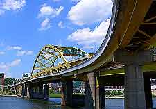
- Following the US-376 highway towards the Fort Pitt Bridge and Tunnel (signposted)
- Head towards the Toll US-60 north, leaving at exit 6
Pittsburgh International Airport (PIT): Virtual Google Maps
